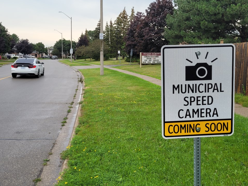
WELLINGTON COUNTY – It’s been in the works for years but the County of Wellington is set to officially get automated speed enforcement (ASE) cameras with the program beginning in 2025.
County council approved a bylaw entering into a contract with Alberta-based Global Traffic Group Ltd. for an ASE program.
Don Kudo, county engineer, confirmed in a phone call with EloraFergusToday this was council’s last step in officially approving the program and now the county will be working with the company for the next six months on the details of the program.
These details include how many cameras there will be and their locations but legislation on ASE narrows down these possibilities.
ASE cameras can only be placed in community safety zones or school zones.
In the case of this program, it will be on county-owned and operated roads as it is a one-year pilot program which will be reviewed with an option for renewal and possibly used on lower-tier municipal roads.
The County of Wellington has nine community safety zones:
- Fergus, Wellington Road 18 (Belsyde Avenue East) from Highway 6 to McTavish Street
- Elora, Wellington Road 18 (East Mill Street) from Chapel Street to Kertland Street
- Elora, Wellington Road 7 from Wellington Road 21 (McNab Street) to Speers Road
- Hillsburgh, Wellington Road 24 (Trafalgar Road) from Church Street to 75 metres north of Jane Street
- Erin, Wellington Road 124 (Main Street) from East Church Street to Millwood Road
- Drayton, Wellington Road 11 (Wellington Street South) from Andrews Drive to Spring Street
- Palmerston, Wellington Road 123 (Main Street) from Henry Street to York Street
- Aberfoyle, Wellington Road 46 (Brock Road South) from 225 metres north of Old Brock Road to 300 metres south of Old Brock Road
- Mount Forest, Wellington Road 6 (Sligo Road East) from 50 metres west of Church Street North to 125 metres west of London Road North.
There are 16 school zones on Wellington County roads:
- Palmerston Public School, Wellington Road 5 (Toronto Street)
- Wellington Heights Secondary School, Wellington Road 6 (Sligo Road East)
- Mennonite School, Wellington Road 16
- Maryborough Public School, Wellington Road 10 (McGivern Street)
- Drayton Heights Public School, WEllington Road 11 (Wellington Street)
- Mennonite School, Wellington Road 8
- Alma Public School, Wellington Road 17 (Peel Street)
- Mennonite School, Wellington Road 86
- Elora Public School, Wellington Road 18 (East Mill Street)
- J.D. Hogarth Public School, Wellington Road 18 (Belsyde Avenue East)
- Maranatha Christian School, Wellington Road 19 (Garafraxa Street East)
- Ross R. Mackay Public School, Wellington Road 24 (Trafalgar Road)
- Brisbane Public School, Wellington Road 124
- Ponsonby Public School, Wellington Road 7
- Sacred Heart ,Wellington Road 27 (Main Street North)
- Aberfoyle Public School, Wellington Road 46 (Brock Road)
Kudo said there will be a report back to council before the program is launched with more details.