NEWS RELEASE
GRAND RIVER CONSERVATION AUTHORITY
*********************
The Grand River Conservation Authority is issuing the following combined flood warning and flood watch message for the entire Grand River watershed.
A low pressure system will move into southern Ontario over the next two days bringing widespread rainfall to the Grand River watershed. The rain is expected to begin late Sunday afternoon and continue through mid-day Tuesday. The bulk of the rain is forecast to fall throughout the day on Monday.
The total forecast rainfall volume associated with this event is uncertain, with multiple weather sources projecting between 50 mm - 100 mm across the watershed. How much rainfall actually occurs will depend on how fast this system moves through the watershed. Due to the uncertainty associated with this weather event, river flow forecasts have been developed using rainfall amounts at the higher end of forecast totals.
A flood warning is being issued for select communities within the Grand River watershed.
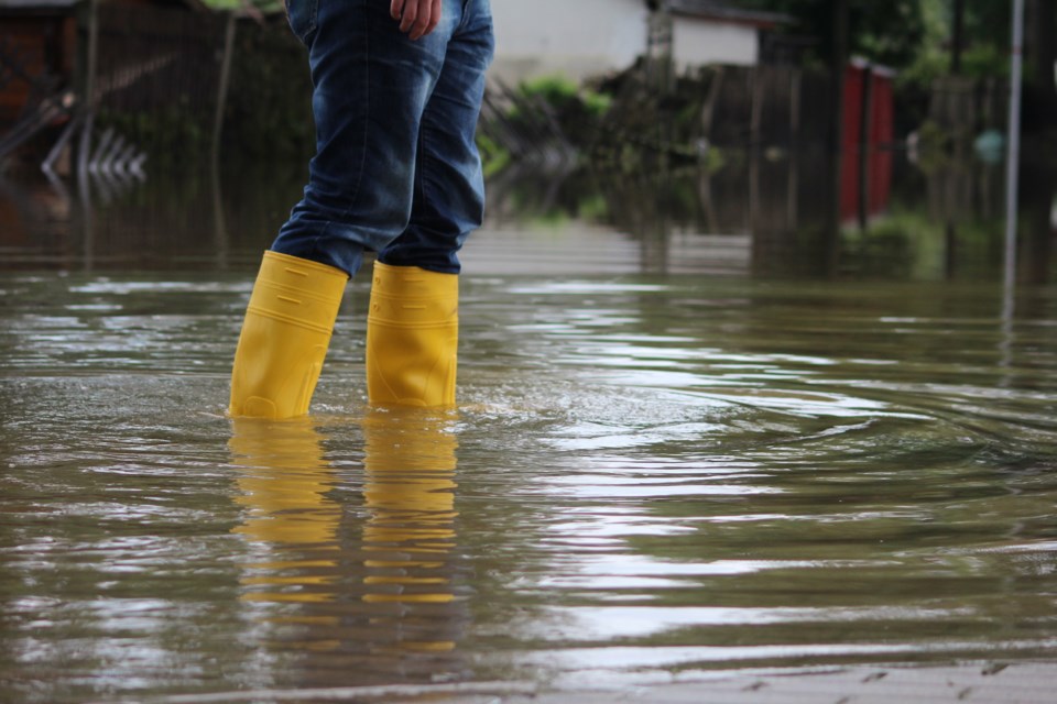
A flood watch is being issued for the entire Grand River watershed. All residents living in the floodplain, who typically experience spring flooding, should take precautions they feel necessary at this time.
The following actions are recommended to municipal flood coordinators:
Flood Warning
Woolwich Township: Flood coordinators are asked to warn residents in Flood Zone 1 through the community of West Montrose and close the low level bridge on Three Bridges Road, upstream of St. Jacobs. Based on the current forecast, flows are expected to peak through West Montrose mid-day Tuesday and through St. Jacobs on Tuesday morning.
Wilmot Township: Flood coordinators are asked to warn residents in Flood Zone 1 through the community of New Hamburg and to advise residents in Flood Zone 2 to be prepared for potential flooding. Flows are expected to peak in the Nith River through New Hamburg on Tuesday afternoon.
Township of North Dumfries: Flood coordinators are asked to warn residents in Flood Zone 1 and Flood Zone 2 through the community of Ayr. Flows are expected to peak in the Nith River through Ayr early Wednesday morning.
Flood Watch
Grand Valley: Flood coordinators are asked to monitor Highway 25 through Grand Valley and be prepared to close the road if necessary. Flows are forecast to peak below the flooding threshold for Highway 25 on Tuesday morning.
Mapleton Township: Flood coordinators are asked to monitor Flood Zone 1 in the community of Drayton. This includes areas of the fairgrounds, which typically experience flooding. Flows through Drayton are forecast to peak on Tuesday morning.
City of Kitchener: Flood coordinators are asked to notify the seasonal campgrounds along the Grand River through the City of Kitchener of potential flood conditions. Significant flooding of these areas is not anticipated based on current forecasts, however flooding of low-lying areas may occur. Flows in the Grand River through Kitchener are expected to peak mid-day Tuesday.
City of Guelph: Flood coordinators are asked to monitor conditions. While significant flooding is not anticipated based on the current forecasts, flooding of low-lying areas typically prone to spring flooding may occur. Flows through the City of Guelph are expected to peak in the Speed River on Tuesday morning.
City of Cambridge: Flood coordinators are asked to monitor conditions. While significant flooding is not anticipated based on the current forecasts, flooding of low-lying areas typically prone to spring flooding may occur. Flows through the City of Cambridge are expected to peak in the Speed River mid-day Tuesday and in the Grand River on Tuesday afternoon.
Brant County, City of Brantford and Haldimand County: Flood coordinators are asked to monitor conditions in these communities and notify the seasonal campgrounds along the southern Grand River of potential flood conditions. While significant flooding is not anticipated based on the current forecasts, flooding of low-lying areas typically prone to spring flooding should be anticipated.
An updated forecast for the Grand River, downstream of Paris, will be issued on Monday, May 18 as this system develops and more precise rainfall data is available.
Based on current forecasts, flows are forecast to peak in the Grand River through Brantford around midnight on Tuesday and through Caledonia early Wednesday morning. Flows are expected to peak through York mid-day Wednesday, through Cayuga on Wednesday evening and through Dunnville overnight Wednesday, into Thursday morning.
Due to uncertainty in the current weather forecasts and the potential for higher rainfall totals, conditions will be monitored closely and updated flood messages will be issued as necessary.
GRCA’s major reservoirs at Belwood, Conestogo, Guelph, Luther, Woolwich, Laurel, and Shade’s Mills are in a normal operating range for this time of year and will be used to manage runoff into local waterways to reduce downstream flooding during this event.
Stay Safe
The public is reminded to exercise extreme caution around all water bodies. Banks adjacent to rivers and creeks are very slippery and, when combined with forecast weather conditions, pose a serious hazard. Parents are encouraged to keep their children and pets away from all watercourses.
This message will be updated by noon on Monday, May 18, 2020. Updated flood messages will be issued as conditions develop and better forecast information becomes available.
More information
- For more information on flows, weather and reservoir conditions see the River Data section of the GRCA website.
- Safety information for parents and children is available in the GRCA’s River Safety Rules booklet.
- More information on the flood warning system is available on the GRCA website.
- Receive GRCA flood messages by e-mail by subscribing through the GRCA website.
- Follow GRCA flood messages on Twitter at grca_flood_msg.
- More information about how the GRCA manages floods is available in the Flooding section of the website.
********************